Monitoring the environment from space or 'Satellite imaging isn't just pretty pictures'
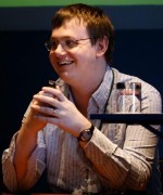
Dr Robin Wilson
- Regions:
- Surrey, West Sussex, Oxfordshire, East Sussex, Buckinghamshire, Hampshire, Isle of Wight, Dorset, Wiltshire
- Notice Period:
- Emergency (maybe less than one week's notice)
- Type:
- Any
- Fee:
- Paid: £100
- Category:
- Science
- Updated:
- 2nd July 2023
- Tagged:
- Geography | Environment | Computing
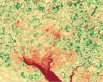
Hundreds of satellites orbit the Earth every day, collecting data that is used for monitoring almost all aspects of the environment. This talk will introduce to you the world of satellite imaging, take you beyond the 'pretty pictures' to the scientific data behind them, and show you how the data can be applied to monitor plant growth, air pollution and more. I can adjust the talk to be more or less technical, as required by the audience, and if I'm given enough notice I try to include satellite images of the area where the group I am speaking to is based.
I have given this talk to a range of groups - including U3A groups, local science groups, classes of secondary school children, and science festivals, with very positive feedback.
I am an expert in satellite imaging, having won the Remote Sensing and Photogrammetry Society's PhD Prize for my thesis in 2014. I have worked in academia, and now work as a freelancer for a range of large and small companies.
Views: 928 | Enquiries: 4About Dr Robin Wilson
I have a First Class degree in Geography, and PhD in satellite imaging & computer science from the University of Southampton. I am a professional speaker on a number of topics including satellite imaging, geography and computing.
As well as giving talks, I currently work as a freelance geospatial software engineer, working with clients ranging from small community groups to multi-national corporations to store, process and visualise geographic data such as satellite images and maps.
I am happy to give talks online or in person, although for in-person talks you should be aware that I use a wheelchair.
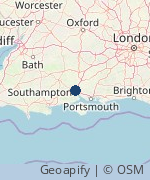
I am based in Southampton, but willing to travel reasonable distances to give talks - always feel free to ask even if you're a bit further away, the worst I can say is no!
Feedback from previous talks has included:
- "The talk that Robin gave to our group was excellent. The clever animated video clips, accompanied by a clear vocal description gave an easily-understood picture of the underlying principles involved. The wide range of topics taken from situations familiar to everyone made the examples pertinent to all present and maintained their interest throughout. A thoroughly enjoyable and thought provoking talk."
- "I guessed your talk would be fascinating and informative - and it was!"
Send a message to the speaker
If you are interested in this talk and wish to contact the speaker, please complete the following form:


